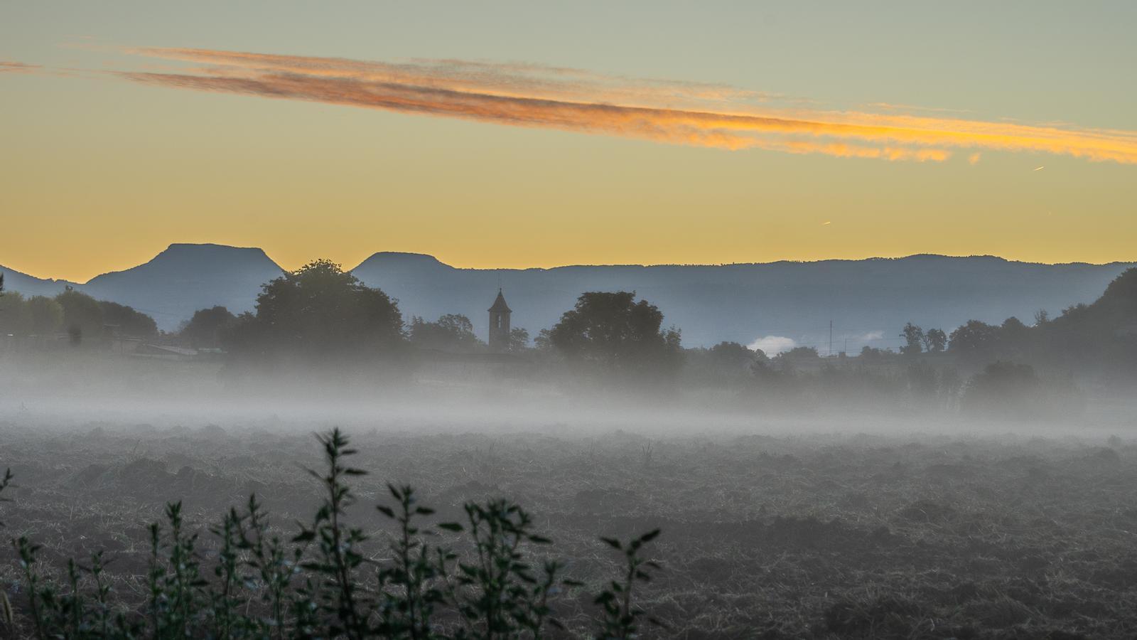
A morning with autumnal air to start a productive Tuesday.
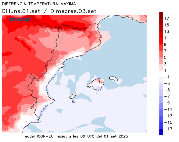
Minimum temperatures have bottomed out, but maximum temperatures will rise somewhat with a warmer atmosphere.
BarcelonaThe week has begun with instability and locally intense storms in some regions, occasionally dumping between 50 and 80 l/m² in parts of the northeast (you'll find all the data and images of the showers from the last few hours at the end of this report). Despite the remnants of a few drops or scattered light showers between the regions of Girona and Barcelona until early morning, Tuesday is set to return to a very calm day with no further precipitation, with sunshine mixed with some cloudy patches. A few showers will reappear between Thursday and Friday, and a new front could arrive next week just before the Diada celebrations. The weather will be warm at midday, with slightly above-average temperatures during the second part of the week, but without any extremes.

Tuesday: Stability prevails
The weather will be more stable today, although some showers or drops may occur until early morning in some coastal and pre-coastal areas between the Barcelona and Girona regions. The rest of the day will be dominated by sunshine with intervals of high and medium-level clouds. A cloudy sky at times, but with no risk of further precipitation on a pleasant day.
The minimum temperature has bottomed out, and we wake up to a cool atmosphere and a hint of early autumn. It's even cold in the Pyrenees, where temperatures have dropped below 10°C in the valleys and below 5°C on the peaks. Many temperatures are hovering early in the morning between 10°C and 15°C inland, between 13°C and 17°C in the pre-coastal area, and between 17°C and 21°C on the coast, even lower on the Costa Brava. However, midday will be somewhat warmer, with highs of 30°C to 33°C in the south of the country.
Quiet Wednesday, with some showers expected on Thursday
The week progresses, and the weather will remain very stable on Wednesday, with even less cloud cover than today. Sunshine will dominate almost everywhere. The minimum temperature will rise slightly, but nightlife will remain cool in most of the country. The maximum temperature will also rise, especially inland, where the increase could be significant in some cases, reaching 34 or 35°C in the warmer areas of the south and west. However, between Thursday and Friday, the weather will become somewhat unstable, with the risk of some scattered, minor showers. The week will end with a stable climate, pending a possible change in the weather next week, just ahead of the Diada long weekend.
Storm balance
Between Sunday and Monday afternoon, showers and thunderstorms reappeared in several regions, especially in Lleida and the northern half of the country. Local downpours left abundant rainfall in some places, occasionally exceeding 50 l/m². On Monday night and Tuesday, some very localized downpours occurred in the northeast, leaving spectacular flashes of lightning offshore. These are the most significant accumulations from this entire storm episode:
- Sils: 81 l/m²
- Jungle Homes: 74 l/m²
- Alfarràs: 66 l/m²
- Sant Feliu de Buixalleu: 58 l/m²
- Ascó: 54 l/m²
- Taganante: 51 l/m²
- Dosrius: 48 l/m²
- Old: 47 l/m²
- Malgrat de Mar and Mataró: 45 l/m²
- Blanes: 41 l/m²
- Arenys de Mar: 40 l/m²
- Olesa de Montserrat: 39 l/m²
